
| Versatile Airborne LiDAR Mapping | Excellence Redefined
Experience unparalleled technological superiority of Leica Geosystems AG, Germany's solutions tailored to your specific needs with Pegasus Enterprise's practical experience & expertise.
Airborne Geospatial LiDAR Systems Overview
Explore our comprehensive range of Leica GeoSystems AG Airborne Geospatial LiDAR Solutions tailored to meet your business needs.
Flexible Scan Patterns
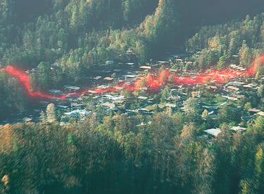
The circle scan pattern enhances 3D modelling of lower-density urban areas or steep terrains, while the ellipse scan pattern optimises data capture in dense urban areas. The skew ellipse scan pattern improves point density for infrastructure and corridor mapping applications.

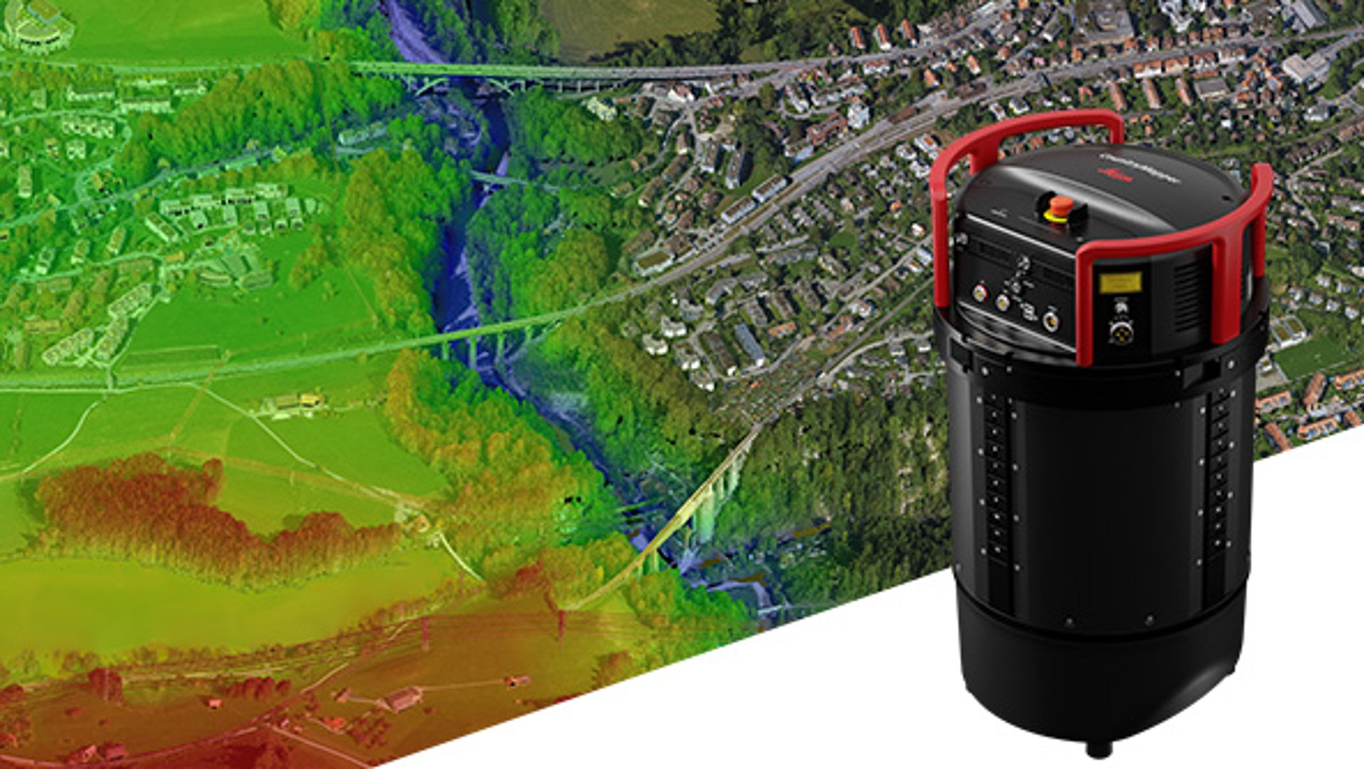
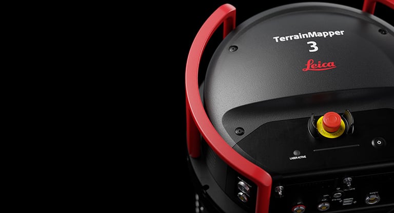
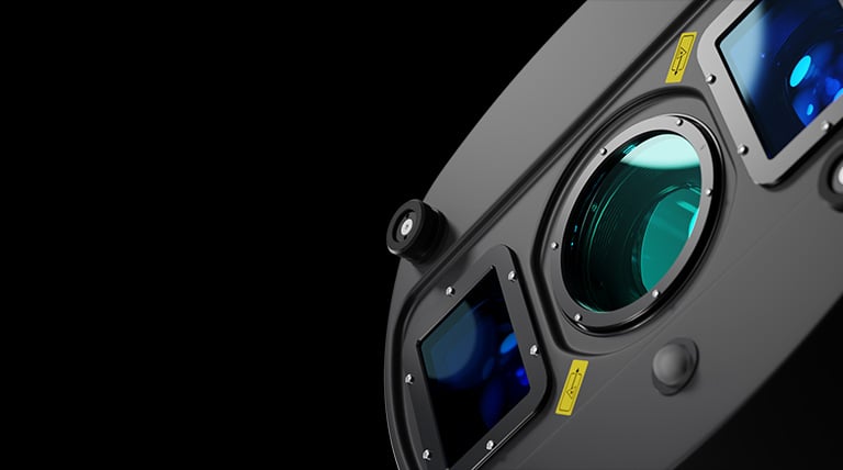
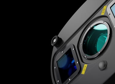
The all-in-one sensor for versatile airborne LiDAR mapping.
The Leica TerrainMapper-3 is the newest linear-mode airborne LiDAR sensor, offering unprecedented flexibility. With enhanced features and upgraded capabilities, it expands the operational range of our airborne LiDAR solutions, enabling users to perform a variety of tasks that previously required multiple systems.
This versatile system can handle applications ranging from wide-area LiDAR data collection to high-density corridor mapping projects. It boasts an adjustable field of view of up to 60 degrees, innovative configurable scanning technology, and simultaneous matching-FOV imagery across four bands, all designed to boost productivity across diverse applications.
Additionally, the sensor integrates effortlessly with Leica HxMap's comprehensive processing workflow, guiding users through mission planning and product generation to maximize the value derived from their data.
Reduced beam divergence improves planimetric accuracy, and the new MPIA handling ensures more consistent data, even in steep terrain. TerrainMapper-3 introduces capabilities for real-time full waveform recording, even at maximum pulse rate, and return pulse attribute output, opening new opportunities for advanced and automated point classification.
High-accuracy Data
Improved Efficiency
The new system puts an efficient, all-in-one solution in the hands of airborne data collection professionals. Higher scan speeds enable users to fly faster while collecting high-quality data. High-performance 2 MHz LiDAR featuring an expanded 60-degree adjustable field of view allows users to capture more data with fewer flight lines.
High-resolution camera
Featuring more than 31,000 pixels across the swath, the camera system ensures exceptional collection efficiency for extensive area coverage. The CMOS-based Leica MFC150 camera modules utilize genuine mechanical forward-motion compensation (FMC) to achieve industry-leading image quality, even at higher aircraft speeds and under difficult lighting conditions.
Discover the new Leica CountryMapper hybrid airborne sensor. The world’s first hybrid imaging & LiDAR system for large-area airborne mapping.
The Leica CountryMapper hybrid airborne sensor integrates a large-format photogrammetric camera with a high-performance LiDAR unit into one cohesive system, allowing for the simultaneous collection of essential geospatial data.
Leveraging Leica Geosystems' specialized knowledge in airborne hybrid technology, this sensor delivers highly accurate and comprehensive 2D and 3D data products tailored to meet a diverse range of customer needs.
The solution seamlessly integrates with the Leica HxMap multi-sensor end-to-end workflow, facilitating the distributed processing of images and point clouds to enhance productivity when handling extensive data sets.

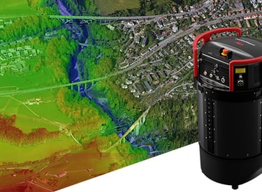
The CountryMapper is equipped with the innovative Hyperion3 LiDAR unit, which boasts a 60-degree field of view, greatly enhancing the system's performance and versatility compared to earlier models. With a pulse rate of 2 MHz, this LiDAR module minimizes laser divergence, resulting in improved planimetric accuracy and superior penetration through foliage.
Full performance LiDAR unit
Foundational Geospatial Data
The sensor facilitates the simultaneous acquisition of aerial images, LiDAR point clouds, Digital Surface Models (DSM), and Digital Terrain Models (DTM) in a single flight. The synchronized camera and LiDAR modules ensure exceptional geometric and temporal data consistency, making it ideal for applications such as orthophoto generation, terrain mapping, hydrography, forestry monitoring, and infrastructure management.
Integrated system
The system fully integrates with powerful Leica HxMap end-to-end processing workflow, supporting customers from mission planning and execution to product generation. Installed in the new Leica PAV200 compact sensor mount, the sensor provides highest sensor stabilisation and data collection efficiency.
Delivering unsurpassed image fidelity for multiple photogrammetric and remote sensing applications
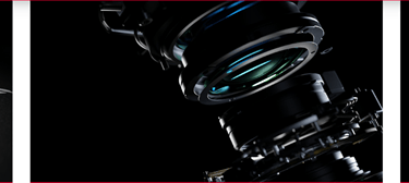
The Leica DMC-4 is a highly effective airborne imaging sensor that offers exceptional image quality for a wide range of applications and complex mapping scenarios. With more than 31,500 pixels across its swath, this system enhances acquisition efficiency and boosts imaging performance by 20% compared to earlier models. It utilizes the CMOS-based Leica MFC150 camera module equipped with mechanical forward-motion compensation (FMC), ensuring the highest level of image detail. Designed with versatility in mind, the DMC-4 supports various photogrammetry and remote sensing applications.
This advanced sensor integrates seamlessly with Leica Geosystems' processing workflow, allowing for efficient mission planning and product generation. The DMC-4's modular design enables easy maintenance and upgrades, ensuring it remains adaptable to future technological advancements. By combining high-resolution imaging capabilities with robust data collection efficiency, the DMC-4 sets a new standard for airborne mapping solutions.


The DMC-4 features the modular MFC150 optical system and proven CMOS technology to deliver the highest accuracy at faster aircraft speeds. Stable, environment-tested lenses and unique forward-motion-compensation (FMC) deliver crisp, full radiometry in a wide range of operating conditions.
Superior image quality
Application versatility
The sensor provides the frame geometry needed to support a wide range of applications such as photogrammetry, remote sensing, terrain extraction and vector mapping. Standard (S) and high (H) focal length configurations enable maximum flying height flexibility in restricted access airspaces.

Increased Productivity
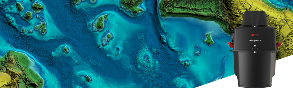
Chiroptera-5 superior sensor performance allows customer to collect more data during every survey flight and to capture larger areas of submerged terrain and objects with greater detail. The sensor is designed to fit a stabilising mount, enabling more efficient area coverage with decreased operational costs.
Operational Flexibility
Bundled with FAA/EASA certified helicopter pod, Chiroptera-5 enables advanced terrain-following flying paths for efficient river mapping and complex coastal surveys. Owners of previous generation system are offered an easy upgrade to add capabilities to their existing sensor.
Leica Chiroptera-5 Bathymetric & Topographic LiDAR
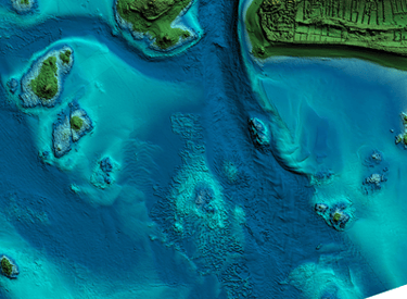
Superior point density and depth penetration for coastal and inland water surveys.
Efficient Workflow
Near real-time data processing enables coverage analysis immediately after landing, allowing operators to QC the data quickly before demobilising the system. The Leica LiDAR Survey Studio (LSS) processing suite provides full waveform analysis and offers automatic calibration, refraction correction and data classification.
Evolving Applications
Combining superior resolution, depth penetration and topographic sensitivity, Chiroptera-5 provides best-in class productivity for various environmental applications such as shoreline erosion monitoring, flood simulation, prevention and benthic habitat classification, habitat mapping and archeological discovery.
Pegasus Enterprise
Elevating your business with aviation solutions.
UAE & Pakistan:
Email: info@pegasusenterprise.com
Contact Us:
For Aircraft, Spare Parts, Airborne GIS Sensors, Ground Support / Handling and Allied Equipment etc.
© www.pegasusenterprise.com 2026. All rights reserved. All trademarks & pictures are properties of their respective owners and are used with permission.

